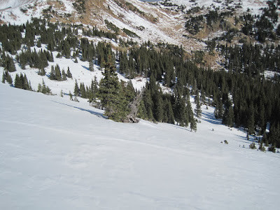
On Dave's exploratory trip to Pumphouse, we investigated new (for us) ski terrain.
 |
| On top of the ridge at Pumphouse. |
During the week, Judi got us thinking about places to ski, and Cathy pointed out Dave's suggestion to explore the Pumphouse basin area south of Berthoud Pass. We had skied the Berthoud Pass ridge last season and seen the tracks on the next ridge to the south, but never had skied there, so it was time to explore.
When Cheryl and I met up with Judi, Cathy, Sue, Mark, and Dave at the HH section of Woolly Mammoth parking lot, the sun was out and the sky was looking pretty blue, with only a few high clouds to hint of the predicted storm coming in from the west. Traffic wasn't bad, but it was evident that the ski traffic was beginning as the cars ducked and weaved between lanes on the way to a stop at Downieville. After a refreshing stop and a battery refill for the beacon, we headed up US 40 and stopped at a plowed lot at the last curve just short of the pass. The dueling Xterra's did not need to compete for parking spaces as the lower lot was empty. Judi and Cheryl had skis and snowshoes but the bare ground at the parking lot convinced them both to wear snowshoes for the trip. Cheryl's decision was helped by the fact that she forgot her skins. Judi demonstrated the versatility of her footwear by fitting her tele boots to her snowshoes.
 |
| Plenty of grass showed through the snow coverage at the trailhead. |
We darted through the traffic to cross the highway, and donned our snowshoes. After a few steps we found ourselves in foot-deep powder. Not quite enough to cover the deadfall, but a delightful experience after months of hard packed snowfields or bare ground. We followed ski tracks part way through the thick trees, then cleared treeline and ascended to the ridge.
 |
| Mark and company enjoy the view from the open slopes. |
 |
| The clouds roll in from the east against the divide. |
After gaining the ridge, the group surveyed the area. The wind insured that the stay was brief as we sought a sheltered spot.
 |
Dave and Mark scope out some promising slopes.
|
 |
| Gazing up valley near No Name avalanche chute. |
Open ski slopes tempt us.
As we headed down from the ridge, the clouds moved in and the snow showers started.
 |
| Storm clouds graze the peak. |
 |
| Clouds are coming. Lunch is over. |
We continued down the valley with several side trips to look at hidden slopes. Ski tracks told the story of other ski trips last week.
 |
| Judi, Cathy, and Dave investigate the slope. |
 |
| Old ski tracks in the trees. Looks like uptracks and down. |
 |
| Heading into the trees as the snow falls. |
 |
| Moving downslope with the highway visible. |
Eventually we intersected our own up track and most headed down, though others could not resist yet another sidetrack.
We had a good trip to get our snow legs going again, though short by mid-season standards. Soon we were back at the cars and headed towards town. After a stop at Beau Jo's, where we had sandwiches but no french fries, we returned to the park and ride and bid farewell to our crew.
(Delete profile to see map.)
 |
| Trip route 3D in Google Earth. |
 |
Trip track, slopes, and avalanche paths.
No. 36 is the "No Name" avy path.
No. 34 is the "Mt Russell S Shoulder" avy path.
|


1 comment:
Hopefully we will read a blog of yours with us skiing the Pumphouse area.
Post a Comment