Wednesday, April 16, 2014

Current Creek Halfpipe 041214

We encountered challenging snow conditions near treeline, but the warm weather held to soften the snow below treeline.


Tom and Nick enjoy the warm weather at the Halfpipe ridge.

Nick and Mike met with Cheryl and Tom at the HH section of the Woolly Mammoth parking lot at 7:30, and we quickly loaded up and headed up to Current Creek. The warm weather during the past week and the forecast for powder later in the weekend ensured low traffic, even around the Idaho Springs Twin Tunnel detour for the eastbound widening construction. The snow stake showed a snow depth below 6 feet, and at the trailhead, the parking lot was down to dirt with temps in the mid-30's.

Down to dirt at the trailhead parking lot.

We skinned up and headed up the trail. It was tough to decide on a destination. Would the sun come out and soften the south-facing slopes? Was there a chance of preserving the powder in the trees on the north-facing slopes despite temperatures of 45° during the week? The clouds looked pretty thick, so we headed up the trail past the Peter Rabbit cabin.

Still some snow at the cabin.
Lured by the appearance of powder in the trees, we ascended the gully to the aqueduct, then up the steep slope to the Halfpipe valley. 

Leveling out at the top of the steep above the aqueduct.

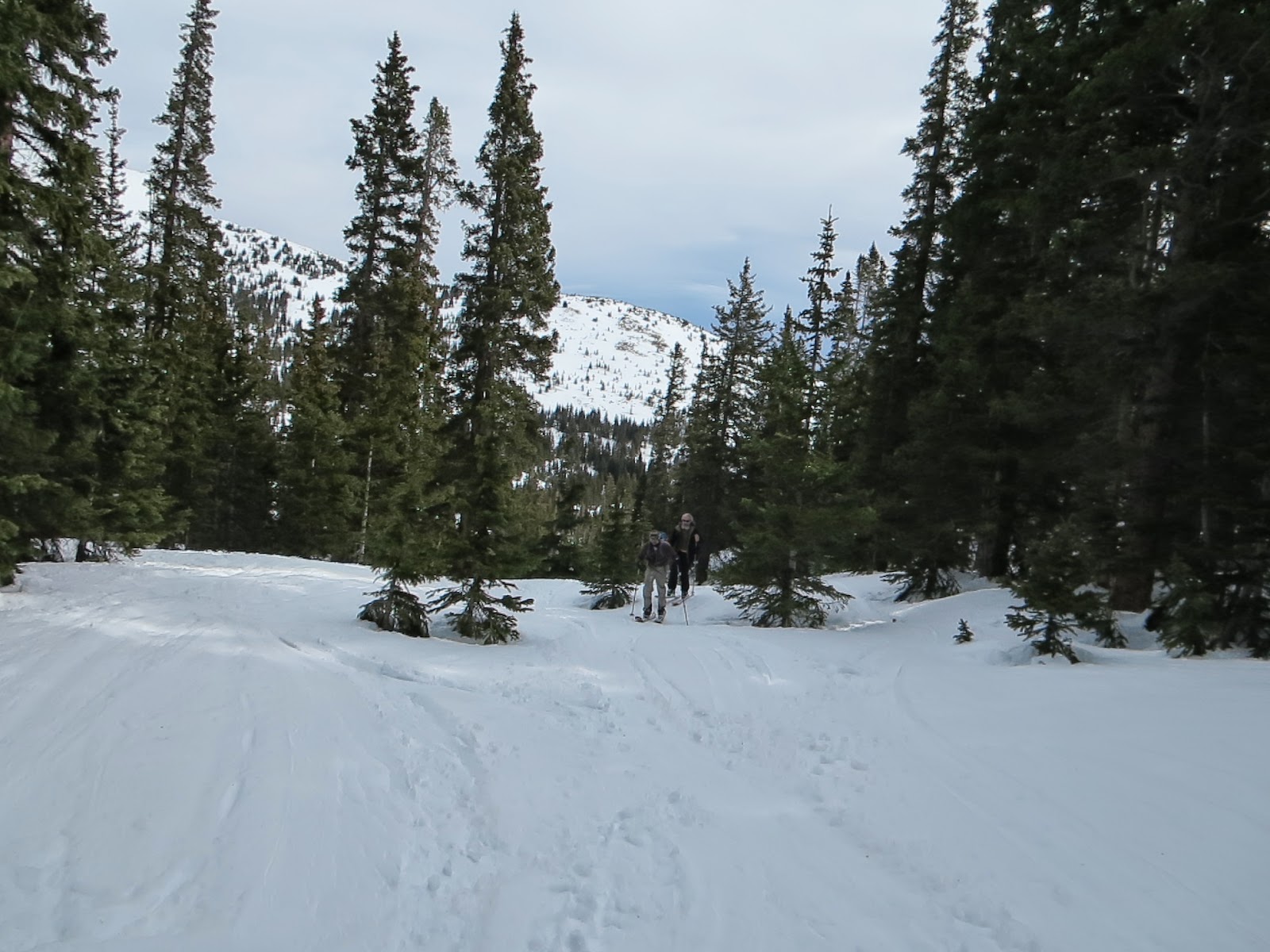
Heading up the Halfpipe valley.

Once we got into the Halfpipe valley, the snow was mostly crusty, with a little bit of softening with the sun and warm temperatures. The predicted snow was pushed back to the afternoon, so we enjoyed the weather while it lasted.

After coming up to the top of the Halfpipe ridge, Cheryl and Nick went down the valley, while Mike and I skied down the ridge to find the "hidden" gulch that we saw on the climber's left on the way up. We were hoping to find some old powder lurking in the shade, but we had to break through some crust to find it.


Cheryl climbs out of the valley to Halfpipe Ridge. 

On the second run, we all skied the valley, though Mike and I went higher up the ridge. I shouldn't have watched "Your Inner Fish" on PBS last week, because I turned into a flounder on the valley floor crust. I totally forgot how to ski on breakable crust. Everyone else adjusted to the conditions. Mike put on a great crust clinic below.


Mike gets ready to ski off the ridge. 


Mike shows us how its done.

After 3 runs, we were done and headed down towards the aqueduct. At the lower elevation, the temperatures were warmer and the snow had softened. Mike took this rare picture of me actually skiing.

I finally remember how to ski.


We made it down from the aqueduct, past the cabin, through the trees, and down to the trailhead and on to Tommyknockers. At least I got good parking.


Where to park at Tommyknockers?

Stats:


Thursday, April 10, 2014

Arapaho Lakes 040514

A warm spring day until the snow came in gave us a pleasant run below the Continental Divide, then an icy luge run down the trail to the parking lot.


Crossing the tarn below the lakes.

I met up with Steve's trip at the East Portal at a decadent 11:00 AM meet time with Steve, Chris, and Scott coming in from Boulder. The parking lot was packed with AT skiers headed for Heart Lake, Haystack, and Rogers Pass.

Another big group gets ready to head up the trail.

The sun was warm and breezes gentle, but high clouds on the divide promised a change later in the day.


High clouds precede the storm.

The first 1200' of the climb to the meadow was uneventful until I started to get snow sticking to my skins, and I mean lots of snow. Steve rescued me with some Glopstopper, which I pressed into the orange part of the skins. It helped for a while, but I wasn't free of the problem until heading down.
At the top of our climb, we watched some AT skiers on a hill that Steve identified as Mt. Frostie.

AT skiers on the Mt Frostie uptrack to the divide. 

We deskinned on a knoll near the lake and looked expectantly to the east for our choice of runs.

Ready to roll.

We encountered some soft wind slab and powder in the open at the top of the run. Once we entered the trees, we found soft powder in the shade. The gullies were tempting with their open slopes, but the sun exposure was not favorable for preserving the dry powder, turning it to a heavy wet version of powder.

All too soon we were back at the upper meadow. The snow moved in, cooling off the temperatures. After a quick bite, we hit the track out, which had converted from wet to icy. Chris followed me into the drainage to avoid the ice, but after a warning from Steve to not linger in the creek, we made several nice powder turns before climbing out to the trail. The drop to the bridge at the creek was as harrowing as ever, and the rest of trip out was relatively mellow, but still fast enough.

Scott gets ready to glide down the trail after the bridge.


At the meadow with the trail junction, the signage was nearly buried, giving us a hopeful prediction for continued skiing through the spring.


Trail junction signs in the meadow are nearly buried.

Snow is really picking up in the meadow.

Back in the parking lot, we were packed up to leave when Svetlota approached us for a ride to her house in Coal Creek Canyon. Her husband was skiing to the divide and after waiting 1.5 hours, she was ready to head home and wait there.

Hitching a ride from the parking lot.
Not many cars left at 5:00.

Scott and Chris in the parking lot.

Stats: 7.3 mi / 2000' / 6 hrs.

ArapahoLakes040514

Saturday, April 28, 2012

Pumphouse 042112

A breezy but warm spring day provided us with rare gelato snow conditions from first run to last.


Joel prepares for the first run.

As usual, we met at 7:30 at Woolly Mammoth HH. Cathy, Phil, Joel, and Rob met Cheryl and me on a warm spring morning. We divvied up the people and gear between two cars, cruised up to Downieville, then on to the Pumphouse trailhead. We were surprised to find a couple inches of snow at the parking area, probably from a small storm on Thursday. After stepping into boots and unloading skis and poles and skinning up, we dashed across US 40 and clambered up the dirt embankment to the snow. 


Old tracks led us up the usual route by the gravel pit. We dodged the old collapse pits along the trail on a well-consolidated base with a couple inches of powder in places. We didn't expect powder on the open ridge as we saw the wind moving the powder off the high peaks on the way in.


Powder is on the move on the ridge.
As we cleared the trees and headed up the gentle nose of the ridge, we noted that the recent storm had smoothed over the rough snow surface, and the sun had already prepped the snow so it was soft enough to ski on our first run at 9:30. Usually we have to make one or two crust runs before the snow is ready, but today was prime skiing from start to end.


At the top, we saw several people had climbed the peak 12424t and were skiing the 40° slopes into the Pumphouse bowl. We stayed on lower ground.
Click the photo to zoom in and see the tracks
off the peak to the climbers left of the cornices.
Cathy and Phil get ready to make a run.
Joel is standing around waiting to make his run.
Phil and Rob de-skin for the run.
Here I demo the perfect tele-wedge technique.  Arghhh!
Before we knew it, we had done 4 runs with only a couple bites of lunch, and it was time to go to make sure the snow supported us on the way out. Pleas for compassion had us wait a couple minutes longer for the slow eaters who were expecting a formal lunch period. We headed down through the trees, dodging exposed ground and logs, and made it safely to the gravel pit, then to the pumphouse itself, and the car.


Stats: 4 runs / 4 hours / 1900' elevation gain.


Saturday, April 7, 2012

Pumphouse 040712

The day started cool, but eventually the sun warmed the slopes enough for some perfect spring corn.
Norm surveys the peaks at the top of Pumphouse ridge.
After seeing the weather reports early in the week, Dave asked for volunteers to take over his trip to Mayflower Gulch. Wishing to honor Dave's intended audience, I only changed the destination, trip description, meeting time, and rating. The usual suspects dropped off the trip, but John joined Cheryl, Norm, and me at the park and ride at 7:30. After a quick trip to Downieville, we were at the Pumphouse trailhead by 8:30. We had the parking to ourselves, and the snowbanks were melted off. Skies were clear, and we were feeling a bit chilly with 30° temperatures when compared to previous weeks in the 50's and 60's. It was nice to see the peaks all white again, after the brown look of the past few weeks.


We gathered up our gear and scampered across the highway to the trailhead. The exposed ground surface had increased in the past two weeks, but the snow at the top of the embankment was still within easy reach. We strapped on the skis and I steered the group towards the edge of the gravel pit to make it easier to find our way out at the end of the day. As backup, I had some GPS waypoints and an old track entered to mark my preferred route. The climb through the tight trees was disorienting, since things looked different with the declining snowpack. Following the GPS, the trees thinned and we soon came to some old tracks that coincided with the GPS track. In the trees was some remnant powder from Monday's 3" dusting, but mostly we found crust with some early sun softening. Emerging from the trees, the uptrack consisted of solid crust, but the surface was smooth due to infill from the early week storm. As we pushed up to the top of the ridge, the winds increased but never reached the predicted 30 mph sustained or 55 mph gusts. 
John and Cheryl climb the uptrack with the highway and Mines Peak in the background.
At the top, we found crust with a roughened surface due to differential melting. After thinking to wait for softening, we instead decided to make a run while waiting. The rough snow was hard to edge and turn in. I reverted to snowplow turns, dropping into parallel when possible.  Below the clump of trees where we often stop, the slope opened up and got smoother. We veered right for the SE facing slope, but it wasn't soft yet either. However, it was smoother making for easier turns. Norm commented later that the run got better after giving up on the idea of making telemark turns. At the bottom, we skinned up and climbed up to near the top.
Cheryl skirts the exposed ground on her way up the hill.
The snowpack is melting out fast this year.
At the top, things hadn't improved much, so we made another run anyway. Norm and John went SE, while Cheryl and I stayed on the main slope. At the very bottom, conditions improved slightly, but enough to try a few tele turns. Cheryl decided to take a break to wait for more improvement, and I headed up to meet up with Norm and John. The third run took us down the main slope, to check on Cheryl, then over to the more southerly facing SE slope, which was very good for the last 100'. The next run nailed it. We found some lovely dirty snow near the top which soaked up the sun, and turned, turned, turned through the trees to the bottom of the SE slope. Cheryl met us after a quick run through the good stuff, and it was time to go. 
Cheryl makes some great tele turns in the corn.
Norm and John at the bottom of the SE run.


Cheryl and Norm relax at the bottom of the slope with perfect corn.
We did a grand traverse around the nose of the ridge, and hit the turnoff to avoid the gravel pit perfectly. The snow in the trees was hummocky with lots of exposed rocks and bare ground. It was a great relief to find that the snow supported us all the way out to the car.
Hummocky snow with bare ground under the trees.
Even more bare ground makes navigation more interesting.


Stats: 4 runs / 1800' / 3.5 miles / 5 hours.


(click the "X" to close the profile and view the map.)

Sunday, April 1, 2012

Current Creek Middle 110s 033112

The end of March saw the continuation of the heat wave. The snow suffered for it, and so did the skiers.


Lots of rocks to dodge due to the thin snow cover.
Tom scheduled the CMC trip to meet at 7:30 at HH, where Wendy, Ginger, and Joel met up with Tom and Cheryl. We loaded up the Xterra and flew to Downieville, then onto the trail head.


We saw a couple of other skiers packing their skis at the parking lot as we strapped on the gear. A few expressed concern at the crusty, uneven snow surface, but Tom assured them that would change. We climbed up a solid surface below Teacup Bowl, following an uptrack similar to the one on Mar 24. As we got to higher ground, the bomb craters from CDOT appeared between the trees.
CDOT avalanche bomb craters above the highway.
The reduction of the snow cover was distressing. Broad open areas of bare ground greeted us on our way to the top, with frequent collapses on the shallow slopes due to the thin snow.
Ginger, Cheryl, Wendy (mostly hidden), and Joel near the top of the Middle 110s.
Note large patch of bare ground behind us.
Large patches of bare ground lurk between the trees.
Nonetheless, we continued to the peak, and deskinned for a run. The warm temperatures made the skin glue extra sticky.
Cheryl gets extra leverage to remove her skins.
Collapsing was most prevalent at the top, tripping up many a skier. As we approached the slope break, we angled over to skiers left to find some less steep pitches, only to discover a distressing number of rocks to avoid. We skied down to the aqueduct and a bit beyond, where the slopes were pitted with rocky obstacles. Next we headed a bit south to skiers right, and skied a nice 100' run into the trees.


It was 11:30 when we skinned up, and we decided to skin up to the top of the steep slope for a final run. 
Wendy de-skins at the top of the second run.
The snow surface was pitted with sun cups, runnels, ridges, and occasional rocks, making the descent a bit interesting. We gathered at the bottom of the run and attempted to make our way out. Our uptrack was melted out, so we ventured closer to the edge of the cliffs in our search of good coverage. As we got lower, the snow strength diminished, leaving us wallowing in collapse pits of our own making. The thin cloud cover of the morning had all but vanished, and the full strength of the sun hastened the snow collapse. We made our way to some rocks and bare ground for a late lunch, welcome after the unsupportive snow. Finally we strapped the skis back on for the final drop to the car.


On our way to Tommyknockers, we consoled ourselves with stories of past ski trips of the season. Tom got a happy hour price for the Pick Ax IPA, plus a free Cocoa Porter that was on the beer engine.


Stats: 2 runs / 1300' / 2.5 mi / 5.5 hrs.
Slope map with current track in magenta.

Current Creek Middle 110s 033112


Sunday, March 25, 2012

Pumphouse 032412

With temperatures soaring into the 70's in town, even Berthoud Pass had 40°+ temperatures to soften the slopes.
High clouds could not delay the softening of the snow.
Cheryl, Norm, and Tom left the park and ride at 7:30 with no other familiar faces in sight. With the warm temperatures discouraging the crowds, traffic was in spring mode with smooth sailing to Downieville. After the quick coffee stop, we headed for the Pumphouse parking lot. The lot was empty as we pulled in, and probably remained empty all day except for our trusty Xterra. The hike to the snow was slightly longer than previous trips this year, but we safely dashed across the highway and up the hill to the snow.

Old tracks were raised up due to the preferential melting of the uncompacted snow around them, but they still provided a guide to the Pumphouse ridge. We took a different route more to the west which caused some steeper climbing in places, even involving some undisturbed along the way. Powder was not part of the plan on this trip as we climbed above tree line up the sunny nose of the ridge.
Cheryl trudges up the nose of the ridge.
After reaching the top, the sun had not soften the slopes to our liking, hindered by the high clouds and smeared contrails. After a patient wait of 5 minutes or so, Norm and Tom decided to kill some time by making a run. Tele turns hard to coax on the hard pack, so we switched to a combination of parallel and snow plow (pizza-french fries) to get through the hard pack. As we descended, the snow softened a tiny amount, but enough to get the tele turns back in gear.

At the bottom of the run, we decided to explore further to the south where the aspect and slope definitely improved the snow condition. On our way up, Cheryl radioed that she was coming down and met us half way. She announced her intention to wait for us to return, then radioed that she was heading down the open south-facing snowfield. 
Norm summits the high point of the run.
For our second run, the snow condition was improved, and by the time we hit the south face, it was perfect. However, but the time we headed up, Norm found a place that collapsed into a pit, and we worked our way around the obstacle. 
Cheryl is thrilled to be at the lunch stop.
At the top, Cheryl and Tom stopped for some lunch, while Norm took an extra run to burn off the goo calories. We all descended the nose of the ridge for the final run, where the aspect, slope, and high clouds combined for perfect conditions.  
Norm heads up for a bonus run.
In the trees we found a combination of crust and a couple of collapsing pits near tree wells, and descended a bit further down the nose than usual. By the time we turned to the north to get off the ridge, we were already below the elevation that would allow us easy access around the gravel pit. Rather than climb, we descended into the pit and found a flat exit towards the parking area.
Norm offers helpful advice for Cheryl.
It's just one little drop, like a cornice jump.
Cheryl demonstrates her ski-glissade method prior to a more conventional descent.
We made our way through the trees with only minor snow collapse, crossed the creek at the pumphouse, and stepped out of the bindings for a short hike to the car.
Still plenty of parking at the trailhead.
We stowed our gear and rolled down the hill to Tommyknockers, where the IPA was still flowing from the beer engine.


Stats: 2.7 mi / 2 - 4 runs / 1400' - 1800'. 
Ski track in red with yellow highlight.