Saturday, June 18, 2011

Hidden Valley 061811

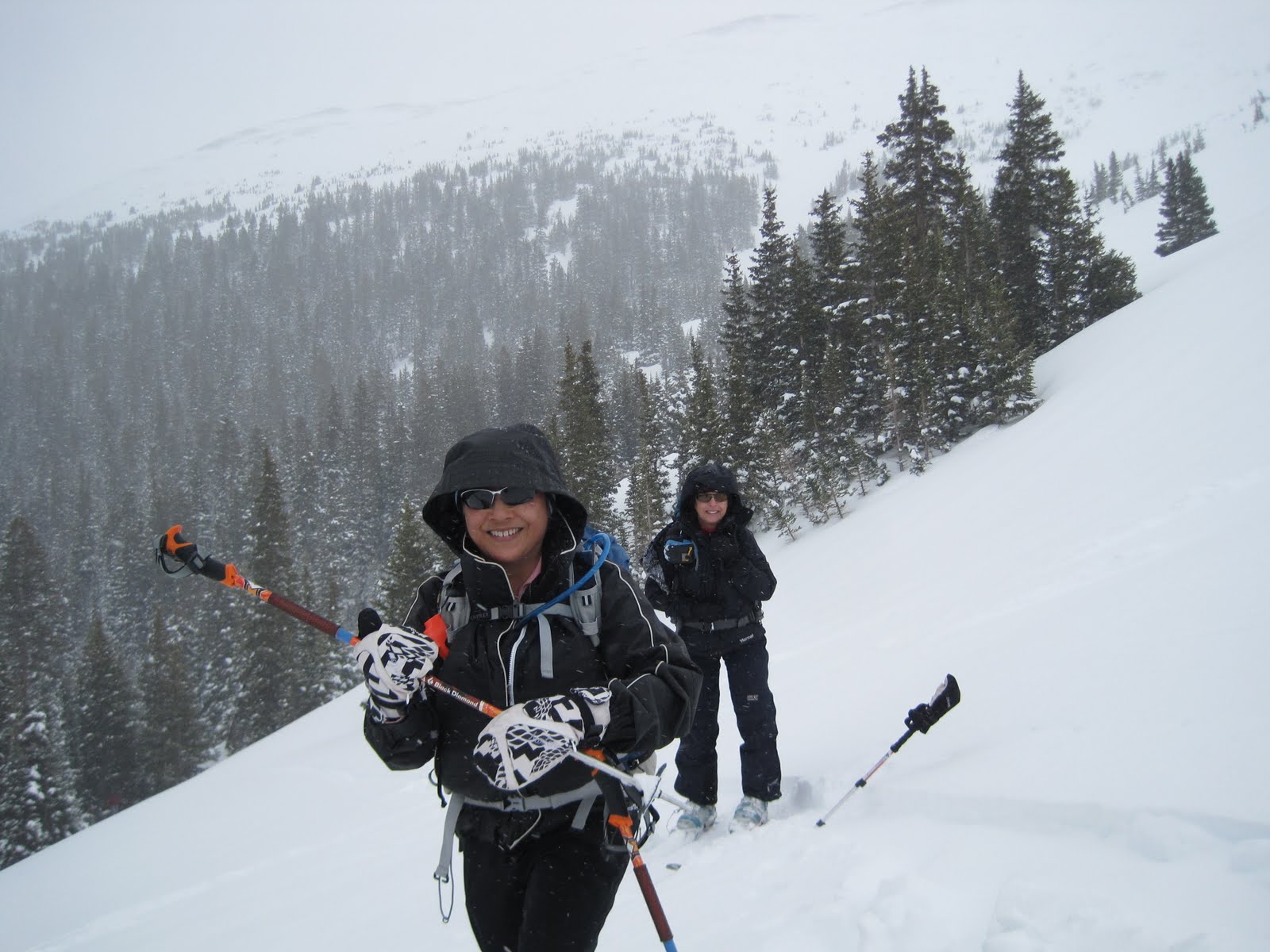
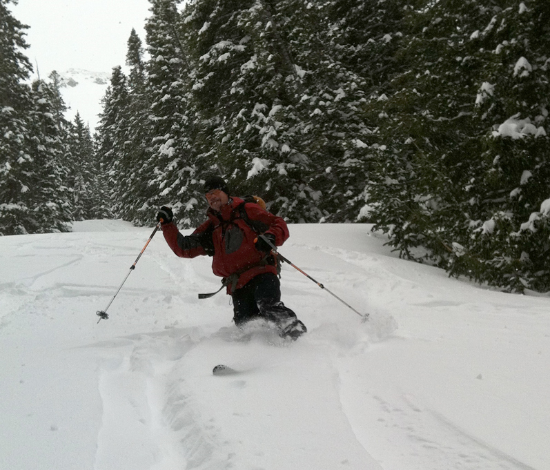
On the last weekend of spring we spent the longest ski day of the year skiing at Upper Hidden Valley in Rocky Mountain National Park.


Picking our way through the krummholz at the ridge.
Cathy organized the meet at the CMC parking lot for Ginger, Fred, Phil, Bob, Cheryl, and me.  We piled into two cars and made it as far as Boulder before a pit stop.  From there it was on through the back streets of Boulder, heading north on 30th until we hit the Diagonal and rejoined 28th / US36 out of town to Lyons and Estes Park.  As we left Estes behind, the high peaks swung into view, with a mound of fluffy clouds at the top.
The high peaks topped with clouds and framed by the windshield of Cathy's Jeep.
With park passes distributed between the cars, we rolled through the toll gates and up Trail Ridge Rd.  Our plans to ski Sundance were thwarted by the road closure at Rainbow Curve, just past Upper Hidden Valley.  Overnight a couple of inches of new snow combined with high winds to clog the route with 2 - 3' drifts, according to reports from the rangers at the road gate.  We retraced our tracks to the Upper Hidden Valley pull-off, and emptied the cars of gear and crew and crossed the road to the trail head.  Snow melt poured from beneath the snowpack at the edge of the road, but the snow surface was still skiable.  We strapped on the boards and headed up the incline.   The new powder had long since turned to mashed by the time we hit the slopes.

Cheryl and the rest of the crew make the climb up the slopes.
We headed up to the trees, then curved around to the southeast to build a longer run.  Unlike our previous experience two weeks ago, temperatures were moderate with a gentle to stiff breeze to further help us keep our cool.  
Cheryl nears the top of the run.
When we started running out of snow, we ran into the rest of the group on their way down.
Fred, Bob, Cathy, and Ginger above the krummholz.
The snow was good enough at the top to make some fun turns, but the going got more difficult down lower.  We followed the drainage through the trees, then cut across the drainage where some organized group with harnesses was having a field day.  The remnants of might drifts were still tall and nearly vertical here, but we contoured around the nose of the drifts and over to some dry ground for lunch.


A fun lunch bunch on dry ground.  Photo by Phil, courtesy of Fred.
At lunch we ran into a couple of characters who knew Ginger.  


Jim sports some stylin' mirrors on his helmet.
After lunch, half the group went straight up 500' for another half a run.  As at lunch, the weather alternated between bluebird skies, squall graupel, and snow.
Phil and Ginger prepare to descend.
Ginger pauses her run.
 The upper slopes were once again fun, but the lower slopes devolved into a mess of runnels and wind-deposited dirt.
Not quite pristine powder.
At the bottom we headed for the cars and packed up to go.  Fred's car scouted the gate at Rainbow Curve and found it had opened after all.  Down at Lower Hidden Valley, we made a changing stop, and found ourselves in the middle of a short-lived cloudburst.  After a quick dash back to the cars, we headed back to Golden.  After a meal and bottomless chips from El Tapatio, we bid a fond adieu to Fred who announced he was hanging up the boards for the season.

Stats: 2.25 mi / 2 runs / 1600'.

Tracks: red: Tom; maroon: Fred.
Zoom out at EveryTrail to see the terrain map.

Monday, June 6, 2011

Hidden Valley 060411

On our first ski trip of June we experienced HOT temperatures and a variety of snow conditions at Rocky Mountain National Park.
Cathy and Sandy de-skin at the top of the snowfield.
Cathy collected the Denver crew at the CMC at the relatively early meet time of 7 am, including Sandy, Phil, Fred, and Bob A.  We loaded up into two cars and headed north to Rocky Mountain National Park.  After a brief stop at the Boulder MacDonalds (next to Sprouts grocery store) on Baseline, we headed north to Rocky Mountain National Park.  At the toll booths both cars had someone qualified for the $10 lifetime pass, so the rest of us lucked into the park for cheap.  Our toll taker announced that he used to run the rope tow at Upper Hidden Valley when the ski area had been open.

The Telemark cabins with snowy peaks from RMNP.
Trail Ridge Road was open to Rainbow Curve, but we pulled over at Upper Hidden Valley pull out.  We skinned up and carried our skis a short distance to the low point of the snow bank.  Despite pictures of 20-foot-high walls of snow, our access was an easy step up from the road.


Luckily, we did not have to climb this wall of snow.
Sandy, Cathy, Bob, and Fred are ready to tackle the climb.
Phil, Sandy, Cathy, and Bob at the trailhead.
Bob was the most prepared for the temperatures, but I had trouble making the shift from winter to summer.  My black shirt and pants soaked up the rays, and fearful of the UV, I tried to keep everything covered up, which was way too hot.  Ii knew I was in trouble when an 80-year-old gent passed me on the uptrack.  Finally, I got the 70 SPF out of the pack, slathered on the juice, and took off layers until I was down to a short sleeved T-shirt.  At last, the climb was tolerable.
Bob is stylin' in his summer knickers.
After a shaky first run on the climbers' right side of the bowl, we were back at the road.  The upper upper slopes above 11,000' had a couple inches of corn, though innumerable boot tracks made the surface uneven.  Down below, it was more like 6 - 8" of slushy corn.  With much of the slope above 25°, it was a challenge to find our way.  Down at the road, we consumed our snacks, drinks, and performance enhancing potions, and headed out towards climbers' left side of the bowl.  
Cathy and Phil prepare for the climb.
Phil and Sandy bask in the sun.
Bob slugs down his energy drink of choice.
Smoke from fires in southwestern Colorado, New Mexico, and even Arizona filled the air with haze and particulates, but they also helped tone down the power of the sun's brutal rays.  The wind picked up as the day went on, making the climb a bit more tolerable.  


Up high towards the ridge, the slightly more north facing aspect yielded some perfect conditions down to about 11,000'.  

Phil gets in touch with his feminine side.
Bob and Fred prepare to descend.  Photo by Phil.
Bob's keepin' cool.
Below that we battled the slush, but with a better feel for the conditions, we made our peace with the conditions and got in some good turns.


Fred picks his way down the bottom of the slope.
Phil does a good job powering his way through the turns.
Bob finishes off the trip with the last of the turns.
After two runs we called it quits.  Back at the cars we lazed in the sun, then headed back to town.


2 runs / 2 miles / 1500'.
This year's track (red) was similar to last year's (black).
Last year's trip was May 22!  View and download track
at Every Trail.  Zoom out to see the topo map.
Posted by Picasa

Sunday, May 29, 2011

Current Creek 052911

Though we received reports of corn before this weekend, this was our first taste of the maizey goodness of spring.  
Cheryl and Sandy gaze at the cornices sluffing.
Cathy herded the entire group into her car at Woolly Mammoth HH, including Cheryl, Sandy, and Norm.  There's nothing like the middle day of a three-day weekend to thin the traffic to a trickle.  At the Downieville stop, we saw mostly shorts-clad travelers, and not a mountain goat or sheep to be found.  It was totally dry in Empire, and we marveled at the avalanche debris found on the sides of US 40 on the way to Berthoud Pass.  At the top, those in the good seats were able see the sluffing off the cliffs on the west side of the pass, then further down the road we saw it on the east side as well.  We arrived at the trailhead at a leisurely 9:30, unloaded the gear and hiked across the mostly dry parking lot over the greatly diminished snow banks to strap on the skis for the climb under perfect bluebird skies and extremely warm temperatures in the 50's.
We took a circuitous route up through Perfect Trees to stay off the already softened aspects where the slope angle was over 30°, and made our way to the top of 11,721'.  Up higher the wind was whipping our skins and other assorted gear, but none of the gear managed to escape.  Is it just a coincidence that corn and cornices go together?  We saw plenty of both from our vantage point at the top.
Second Creek cornices.
Current Creek cornices.


The corn was a couple inches deep on top, a perfect balance between hot sun and cool winds.  As we reached the steeper slopes by the aqueduct, the corn got lots deeper, protected from the winds or angled more directly into the sun. We plowed our furrows ever deeper as we descended about 500' from the top.  Norm and I descended an extra 50' above the 120's, then we skinned up and met the rest of the group for the climb.  The temperature made the slog grueling at times, especially covered up against the broiling UV rays, then a blast of wind would bring welcome relief.  Towards the top, the wind reigned supreme, and it was time for a shell and a bite to eat in the trees.  On the second run we stuck a bit closer to the trees.  
At the bottom, it was time to skin up and climb up again.  At the top, we got a good look at the additional cornice sluffing that had occurred, as well as the building clouds that gratefully never developed into thunderstorms or rain.


We made our way back down through the Perfect Trees, giving the steeper slopes a wide berth.  However, our route took us down a slope where I discovered at least one rock lurking below the surface, causing an especially picturesque fall.  Despite this mishap, we all made it down to the trailhead in one piece.  After clambering out of our bindings, we made our way over the snowbank to the car, then onward to Tommyknockers.

Except for that one rock, we found plenty of snow for skiing.  The depths are amazing for this time of year.

3 runs / 4 miles / 2100'

Track superimposed on slope and avalanche map.


Posted by Picasa

Monday, May 23, 2011

Butler Gulch 052111

A foot and a half of powder made for a fine day of Mayuary skiing.


Cathy gathered the troops at 8 at Woolly Mammoth HH, including Cheryl, Sandy, Judi, Fred, and Bob A.  After a brief stop at Downieville we made our way towards Henderson mine.  It was raining at Empire, but the rain turned to snow as we gained altitude.  At the trailhead we were thrilled to find 6 - 8" of powder with light snow or flurries all day.  As we skinned up, we ran into some dawn patrollers who had already finished their runs.  They relayed the news about the good conditions to come to those who climb.


As we split off from the Jones Pass Rd to take the Butler Gulch trail, the familiar gate blocking motorized vehicles was replaced with a sign post.  The massive amount of snow had buried the gate, leaving only a bit exposed at the edge of the gully.
Steph points out the sign post replacing the buried gate.
The edge of the gate pokes out of the accumulated snowpack.
At the "Y" above the switchbacks (also known as the "V"), we split into two groups, with Cathy taking some of the group towards the ridge and I took some of the group into the runs on climber's right of the uptrack.  The powder was heavy and a bit of a challenge, but we managed to find a good line through the untracked powder.  


Cheryl and Sandy are all smiles getting ready for the first run.
For the second run we went way to the climber's left at the "Y", following a snowshoe track into one of the gullies in the trees.  There we briefly ran into the rest of the group.  They continued down as we climbed a bit higher, then dropped into the popular run.  The tracks made for some nice grooming, but the slow going through the untracked powder made us wary of our turns.  


At the bottom of the gully we hit the uptrack, where we ran into Steph P and Rob.  My group was ready to head back to the cars, so Steph and Rob graciously adopted me for the next climb.  We headed up towards the ridge, stopping at a knoll that we hoped would carry us to the skiers left above an untracked run above the "Y".  Rob stayed high and cleared the hollow, but Steph and I ran into a vertical wall of a cross-loaded cornice.  After breaking through to the other side, we traversed to the run and enjoyed some excellent conditions above the "Y".  With each turn, we sunk into the powder, only to pop back up at the completion of the turn.  
At the "Y" we ran into Bob and Fred, supposedly looking for me, or was it to make a third run?  Perhaps a little of both.  They continued on up, while we made our way down the trail.  
Tom descends the gully below the ""Y".
Photo by Steph.
After a suitable period of quad burning, we glided into the parking lot, where we met up with many of the same people that we had started with.  Judi proudly showed the marks from her battle with some unruly branches.

Mere branches cannot deter this woman.
Jenny's was closed in the morning and afternoon, which clinched our apres ski decision to stop at Tommyknockers.

3 runs / 5 miles / 2000' elevation.

Topo and air photo with track detail.

Saturday, May 14, 2011

Apex / Jenny Lind Gulch 051411 or Gorillaz in the Mist

misty foggy day at lower elevation salvaged the day with surprising spring skiing.
Wendy materializes out of the fog.
Cathy rounded up the usual suspects, including Wendy, Cheryl, Sandy, Diane W, Bob, Phil, and Fred.  We departed from the lot across from the CMC and headed up US 6 towards Blackhawk.  After a brief stop at Bullwhackers gas station where skiers and non-skiers eyed each other with equal amounts of curiosity, we headed on past Blackhawk to the turn off for Apex.  The cloud base was low, and we moved ever closer as we gained altitude.  At the trailhead, we gingerly avoided the mud puddles as best we could as we unloaded the gear and skinned up.  The temperatures hovered near freezing, and the snow was soft and wet.  We ascended to the saddle, and took the contour road towards the middle of the bowl.   Finding this route from the saddle is easy if you know to look for it, but finding it from the bowl can be maddeningly difficult if you don't have tracks or GPS waypoints, as I found out the hard way on a previous trip. 

We emerged from the trees and climbed to about 10,550' where the ridge flattened out.  We de-skinned in the fog as the drizzle turned to tiny icy pellets that wafted in th breeze.  


Any concerns about our skis sticking in the wet snow quickly vanished as we discovered that the temperatures had provided the snow surface with a thin icy topping that provided more than enough glide to compensate for the heavy wet snow beneath.  Combined with the intermittent near total gray-out, it was a challenge to tell the difference between up and downhill.  


Phil descends into the mist.
Phil, Bob, and Wendy appear out of the fog.

Using periodic calls into the void and echo-location, we somehow managed to regroup at the bottom of the slope.  After a quick snack, we made the ascent for another run.


After a couple more runs, we met at the bottom and decided to take the switchback route out.  Following the existing tracks, we made the easy climb to the saddle, then down to the car.  The descent proved tricky, as the icy topping was thicker and more difficult to cut through to make turns in the trees.  We packed up the gear and headed back go Golden.

3 runs / 3.7 mi / 1700'
Interactive track, GPX, and pictures also at EveryTrail.