Saturday, July 2, 2011

Sundance 070211

Beautiful summer temperatures, perfect corn snow, and great friends made for a fantastic trip to Sundance.
The lineup.
I gathered Cheryl, Cathy, Sandy, Phil, and Bob at the CMC, and we headed to Boulder to pick up Judi. After stops in Boulder and the visitor center, we made our way to the Sundance parking lot past Rock Cut. Traffic was moving but pretty heavy, as expected for the holiday weekend. We piled out of the cars and unloaded skis, packs, and gear. We strapped them all together on the sidewalk and headed up the path to the snowfields.

Hey, watch out with those skis.
The trailhead had bunches of wildflowers, including fairy primrose, forget me not, baby sky pilot, and cinquefoil.
Fairy primrose. Photo by Judi.
Will hike for turns.
On the way to the snow.
 We reached the snow on the other side of the rocks at the end of the trail, and unstrapped the skis from the packs and slid our boots into the bindings. Ahh, snow!
Finally on the snow.
Ready to ski.
Take the picture so we can ski.
The temperatures and the snow were perfect. Sunny but 60's, good breeze to keep cool. The coverage was even better than last year on Jun 5.
Down the slope.
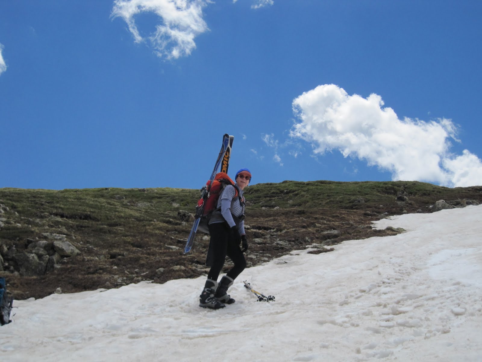
The snow had less dirt than last year, and the skis glided with ease. Before we knew it, we were at the turn-around point after a great 700' descent. Now, it was time to pay for all those great turns with a climb to the top. Some chose to boot pack, while others skinned up.  
Heading back up.
Out of the abyss.
Getting closer.
Not as steep.
Smiles = Almost to the Top.
At the top we had a snack and a Spanish lesson (nos gusta esquiar).  Hostilities broke out in the form of a brief snowball battle.  Despite the underage reinforcements recruited from passing tourist families, the battle ended inconclusively.
Incoming at 12 o'clock.
We turned around and headed down again. Snow conditions remained wonderful. But we reached the bottom all too quickly and prepared to head back up.
Leaning into the hill.
Uptrack.
Lunch #2.
At our second lunch we hung out in the beautiful weather and views.  Many headed down for a third run.
Gliding into the turns.
What's down below?
Picking the line.

Cinquefoil and ski boots.
Lots o' turns.
Even after the last brutal climb, we were giddy with excitement over the great skiing in July. We all thank Naoki for showing us this fantastic ski spot.
Everyone is happy after a great day.
On the way back to the cars.
After we loaded all the gear in the cars, we made a quick trip to the alpine visitor center, then crawled back to Estes park.  We dropped Judi off at her car only 30 minutes later than her scheduled dinner, then drove to Golden and stopped at Santiago's for some super food.
Hungry.

Trip route looking south in Google Earth.
Trip stats: 4 mi / 3 runs / 2100'.
Topo and slope map.  Current trip in red.  See also EveryTrail.

Saturday, June 18, 2011

Hidden Valley 061811

On the last weekend of spring we spent the longest ski day of the year skiing at Upper Hidden Valley in Rocky Mountain National Park.


Picking our way through the krummholz at the ridge.
Cathy organized the meet at the CMC parking lot for Ginger, Fred, Phil, Bob, Cheryl, and me.  We piled into two cars and made it as far as Boulder before a pit stop.  From there it was on through the back streets of Boulder, heading north on 30th until we hit the Diagonal and rejoined 28th / US36 out of town to Lyons and Estes Park.  As we left Estes behind, the high peaks swung into view, with a mound of fluffy clouds at the top.
The high peaks topped with clouds and framed by the windshield of Cathy's Jeep.
With park passes distributed between the cars, we rolled through the toll gates and up Trail Ridge Rd.  Our plans to ski Sundance were thwarted by the road closure at Rainbow Curve, just past Upper Hidden Valley.  Overnight a couple of inches of new snow combined with high winds to clog the route with 2 - 3' drifts, according to reports from the rangers at the road gate.  We retraced our tracks to the Upper Hidden Valley pull-off, and emptied the cars of gear and crew and crossed the road to the trail head.  Snow melt poured from beneath the snowpack at the edge of the road, but the snow surface was still skiable.  We strapped on the boards and headed up the incline.   The new powder had long since turned to mashed by the time we hit the slopes.

Cheryl and the rest of the crew make the climb up the slopes.
We headed up to the trees, then curved around to the southeast to build a longer run.  Unlike our previous experience two weeks ago, temperatures were moderate with a gentle to stiff breeze to further help us keep our cool.  
Cheryl nears the top of the run.
When we started running out of snow, we ran into the rest of the group on their way down.
Fred, Bob, Cathy, and Ginger above the krummholz.
The snow was good enough at the top to make some fun turns, but the going got more difficult down lower.  We followed the drainage through the trees, then cut across the drainage where some organized group with harnesses was having a field day.  The remnants of might drifts were still tall and nearly vertical here, but we contoured around the nose of the drifts and over to some dry ground for lunch.


A fun lunch bunch on dry ground.  Photo by Phil, courtesy of Fred.
At lunch we ran into a couple of characters who knew Ginger.  


Jim sports some stylin' mirrors on his helmet.
After lunch, half the group went straight up 500' for another half a run.  As at lunch, the weather alternated between bluebird skies, squall graupel, and snow.
Phil and Ginger prepare to descend.
Ginger pauses her run.
 The upper slopes were once again fun, but the lower slopes devolved into a mess of runnels and wind-deposited dirt.
Not quite pristine powder.
At the bottom we headed for the cars and packed up to go.  Fred's car scouted the gate at Rainbow Curve and found it had opened after all.  Down at Lower Hidden Valley, we made a changing stop, and found ourselves in the middle of a short-lived cloudburst.  After a quick dash back to the cars, we headed back to Golden.  After a meal and bottomless chips from El Tapatio, we bid a fond adieu to Fred who announced he was hanging up the boards for the season.

Stats: 2.25 mi / 2 runs / 1600'.

Tracks: red: Tom; maroon: Fred.
Zoom out at EveryTrail to see the terrain map.

Monday, June 6, 2011

Hidden Valley 060411

On our first ski trip of June we experienced HOT temperatures and a variety of snow conditions at Rocky Mountain National Park.
Cathy and Sandy de-skin at the top of the snowfield.
Cathy collected the Denver crew at the CMC at the relatively early meet time of 7 am, including Sandy, Phil, Fred, and Bob A.  We loaded up into two cars and headed north to Rocky Mountain National Park.  After a brief stop at the Boulder MacDonalds (next to Sprouts grocery store) on Baseline, we headed north to Rocky Mountain National Park.  At the toll booths both cars had someone qualified for the $10 lifetime pass, so the rest of us lucked into the park for cheap.  Our toll taker announced that he used to run the rope tow at Upper Hidden Valley when the ski area had been open.

The Telemark cabins with snowy peaks from RMNP.
Trail Ridge Road was open to Rainbow Curve, but we pulled over at Upper Hidden Valley pull out.  We skinned up and carried our skis a short distance to the low point of the snow bank.  Despite pictures of 20-foot-high walls of snow, our access was an easy step up from the road.


Luckily, we did not have to climb this wall of snow.
Sandy, Cathy, Bob, and Fred are ready to tackle the climb.
Phil, Sandy, Cathy, and Bob at the trailhead.
Bob was the most prepared for the temperatures, but I had trouble making the shift from winter to summer.  My black shirt and pants soaked up the rays, and fearful of the UV, I tried to keep everything covered up, which was way too hot.  Ii knew I was in trouble when an 80-year-old gent passed me on the uptrack.  Finally, I got the 70 SPF out of the pack, slathered on the juice, and took off layers until I was down to a short sleeved T-shirt.  At last, the climb was tolerable.
Bob is stylin' in his summer knickers.
After a shaky first run on the climbers' right side of the bowl, we were back at the road.  The upper upper slopes above 11,000' had a couple inches of corn, though innumerable boot tracks made the surface uneven.  Down below, it was more like 6 - 8" of slushy corn.  With much of the slope above 25°, it was a challenge to find our way.  Down at the road, we consumed our snacks, drinks, and performance enhancing potions, and headed out towards climbers' left side of the bowl.  
Cathy and Phil prepare for the climb.
Phil and Sandy bask in the sun.
Bob slugs down his energy drink of choice.
Smoke from fires in southwestern Colorado, New Mexico, and even Arizona filled the air with haze and particulates, but they also helped tone down the power of the sun's brutal rays.  The wind picked up as the day went on, making the climb a bit more tolerable.  


Up high towards the ridge, the slightly more north facing aspect yielded some perfect conditions down to about 11,000'.  

Phil gets in touch with his feminine side.
Bob and Fred prepare to descend.  Photo by Phil.
Bob's keepin' cool.
Below that we battled the slush, but with a better feel for the conditions, we made our peace with the conditions and got in some good turns.


Fred picks his way down the bottom of the slope.
Phil does a good job powering his way through the turns.
Bob finishes off the trip with the last of the turns.
After two runs we called it quits.  Back at the cars we lazed in the sun, then headed back to town.


2 runs / 2 miles / 1500'.
This year's track (red) was similar to last year's (black).
Last year's trip was May 22!  View and download track
at Every Trail.  Zoom out to see the topo map.
Posted by Picasa